AFSOC Data Collection System
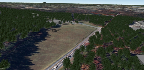
The Air Force Special Operations Command (AFSOC) through their special operations squadrons known as "Special Tactics", asked us to participate on a development project. The objectives were to combine high precision GPS equipment from Trimble® and pair it with an AutoCAD® system that would read the collected data and automatically generate geosynchronous intelligent data with imagery. This survey data is proofed by mission planning and various commands, then provided on-line on secure servers worldwide. The primary objective was to shrink the timeline from "boots on the ground" to delivering viable survey documents to command for accurate mission planning and execution.
After five years of development, the system was accepted for field use and put to the test. The first significant test was the re-survey of Iraq. When the U.S. entered the Iraq war in March of 2003, all military air assets and facilities within the country were surveyed including airports, air bases, potential landing zones and drop zones, about 60-70 locations total. This process took over two and a half years. In 2010, two teams with the Data Collection System (DCS) re-surveyed the entire inventory and it was completed in less than 60 days. The resulting data provided better, more accurate and completely standardized documentation.
A second test came in the form of a small emergency. Some military personnel with heavy equipment were stranded in remote location due to the weather and road conditions. To extract them and their equipment rapidly, large aircraft were required. Teams with DCS were dispatched to appropriately sized landing sites near the stranded personnel. The teams collected surveys and passed the data via satellite uplink to the operations center. This data was compiled by our program into surveys that could be evaluated for the mission and a suitable landing site for C-130 and C-17 aircraft were approved. The whole process from "boots on the ground" to sending aircraft to extract the stranded personnel was less than 48 hours.
- Project Partners:
- Special Tactics Solutions
- GeoSpacial Innovations


.bmp)